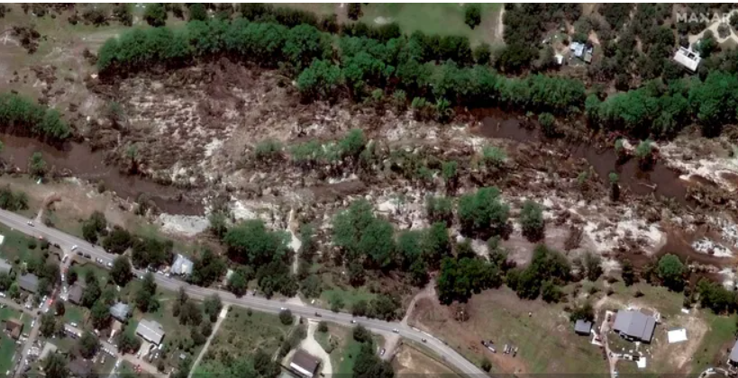
New satellite images illustrate the force and path of the devastating July 4 flood waters that washed out homes and vegetation along the Guadalupe River in Texas.
More than 100 are dead as the search for more than 160 missing people continues in Kerr County, which received the brunt of the flooding impacts. The death toll has steadily risen while search and rescue teams, in addition to volunteers, comb through debris.
The last “live rescue” was made on Friday, July 4, said Jonathan Lamb with the Kerrville Police Department, and the chances of finding survivors dwindle as time passes.Live updates: Search teams scour for more than 160 still missing in Texas flooding
Before and after satellite images provided by Maxar Technologies show the effects the flooding had on the area surrounding Camp Mystic. According to its website, Maxar Technologies is a “leading provider of secure, precise geospatial insights.”
Satellite images show effects of Texas flooding

The Guadalupe River before and after flooding


Girls still missing from Camp Mystic
At least 27 of the flooding deaths were children and counselors at Camp Mystic, a beloved girls’ Christian camp that sits along the river. It, along with homes and campgrounds in the area, was inundated in the early morning hours on Friday with little time to act. There are still five missing campers and one counselor from the camp, officials said.